Ancient technology, meet the future of underwater archaeology
- Suzanne Ahearne

Using some of the newest technologies in underwater archaeology, Quentin Mackie (anthropology) and Alison Proctor (engineering) may have discovered one of the oldest archaeological finds in Canada.
Right now all they know for sure is that they’ve discovered a line of basketball-sized rocks on the seafloor. Those rocks may well add to the mounting evidence about the ingenuity of an ice age people who lived and thrived on the west coast of Canada while much of Europe was still under ice. It’s a tantalizing possibility.
Vast grasslands, flooded
“It is a very emotional experience,” Mackie said, “to look at these images and think that what we might be looking at is evidence that people were living on this land and catching salmon before there was even a forest here, when it was still a grassland almost 14,000 years ago.”
If further investigation by a seafloor geologist rules out a natural explanation for this line of boulders 122 metres underwater, the find will also provide further evidence of the human occupation of Haida Gwaii—at a time of extreme environmental change that also coincides with the Time of Transformation from Haida oral history.
That it might be a fish weir is not such a huge inferential leap, Mackie said. As he describes it, “the table was already set.” Previous research by himself, Daryl Fedje (assistant professor of anthropology, whose work is funded by the Tula Foundation) and others had already turned up evidence of 12,800 year-old human habitation close by from a time when sea levels were 100 metres lower than today. They had DNA evidence of up to 14,000-year-old salmon and detailed bathymetry (underwater maps) showing a drowned landscape of river systems and areas that could have supported small village sites.
Setting discovery in motion
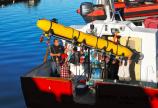
The idea to go looking for ancient fish weirs was, at first, a futuristic dream. But when Mackie came across a picture of an autonomous underwater vehicle (AUV) with the UVic crest on it, he quickly reached out and found Colin Bradley, director of the Ocean Technology Lab, and the lab’s research engineer, Alison Proctor. They’d both been part of the team operating the 3.5-metre long, $1.5-million Bluefin Robotics vehicle during the 2012 search for the Franklin shipwrecks.
The engineers loved Mackie’s idea. Mackie and Bradley, with help from the engineering’s faculty development office, set them up with funding from the Ronald Ramsay Trust. The rest is, as they say, history—recent and ancient, all at once.
A summer lab, at sea
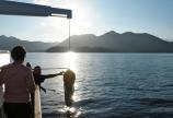
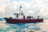
Less than six months later, Mackie and Proctor (as the project’s technical lead and AUV operator) are back from a late-summer research trip to Gwaii Haanas National Park Reserve, at the southern end of the Haida Gwaii archipelago. The marine and terrestrial protected area, managed cooperatively by the Government of Canada and the Haida Nation, is also the site of most of Mackie’s life’s work. Gwaii Haanas threw their full support behind the project, providing a Parks Canada research vessel (Gwaii Haanas II), the skipper and crew.
Along with Fedje and Jacqueline LeMaistre (AUV support technician), Mackie and Proctor spent eight days surveying seven square kilometres of the seafloor with side-scan sonar mounted on the AUV. Very similar technology discovered and provided images of the Franklin shipwreck this summer.
They’ve been poring over all the sonar imagery in the 150 gigabytes of data, looking for rectangles, straight lines—anything that looks out of place or unnatural. Their short list of promising finds includes a row of rocks in what would have been a stream bed feeding into a river system. At least, that’s what it would have been before hundreds of square kilometres of coastal plain were flooded by the sea, forcing the inhabitants higher into the islands of Haida Gwaii. Placement indicates these rocks could be a stone fish weir, a simple and ancient technology used by peoples all over the world to catch migrating fish in rivers. If it were, it would also be the oldest known fish weir in the world.
“Without the AUV, this discovery would have been much more difficult,” said Proctor. These locations are too deep for divers and surveying the underwater canyons would have been challenging using a towed side- scan system. AUV-mounted sonar collects crystal-clear imagery, which is especially important when looking for small features in the sonar record, she said.
Mackie will spend this winter poring over scans with experts. Next summer, he and Proctor plan to return to a few pinpointed locations, dropping a remotely operated vehicle to the same depth, with high hopes they might find stone tools and collect video of the locations.


